
Southern Fleurieu Coastal Action Plan


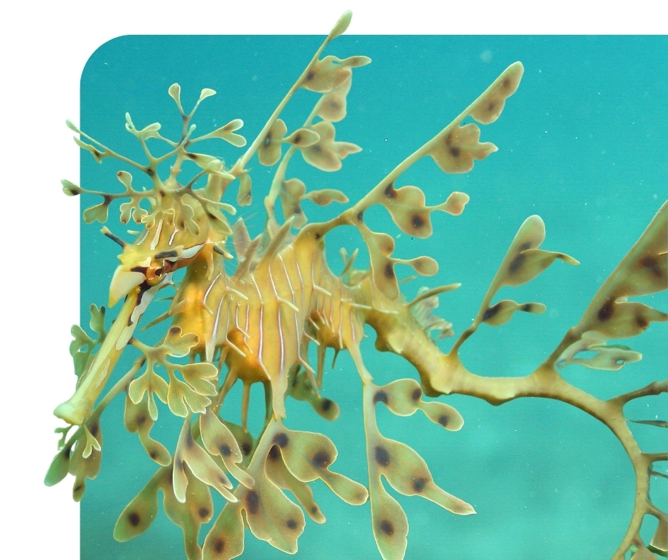
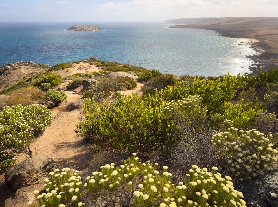
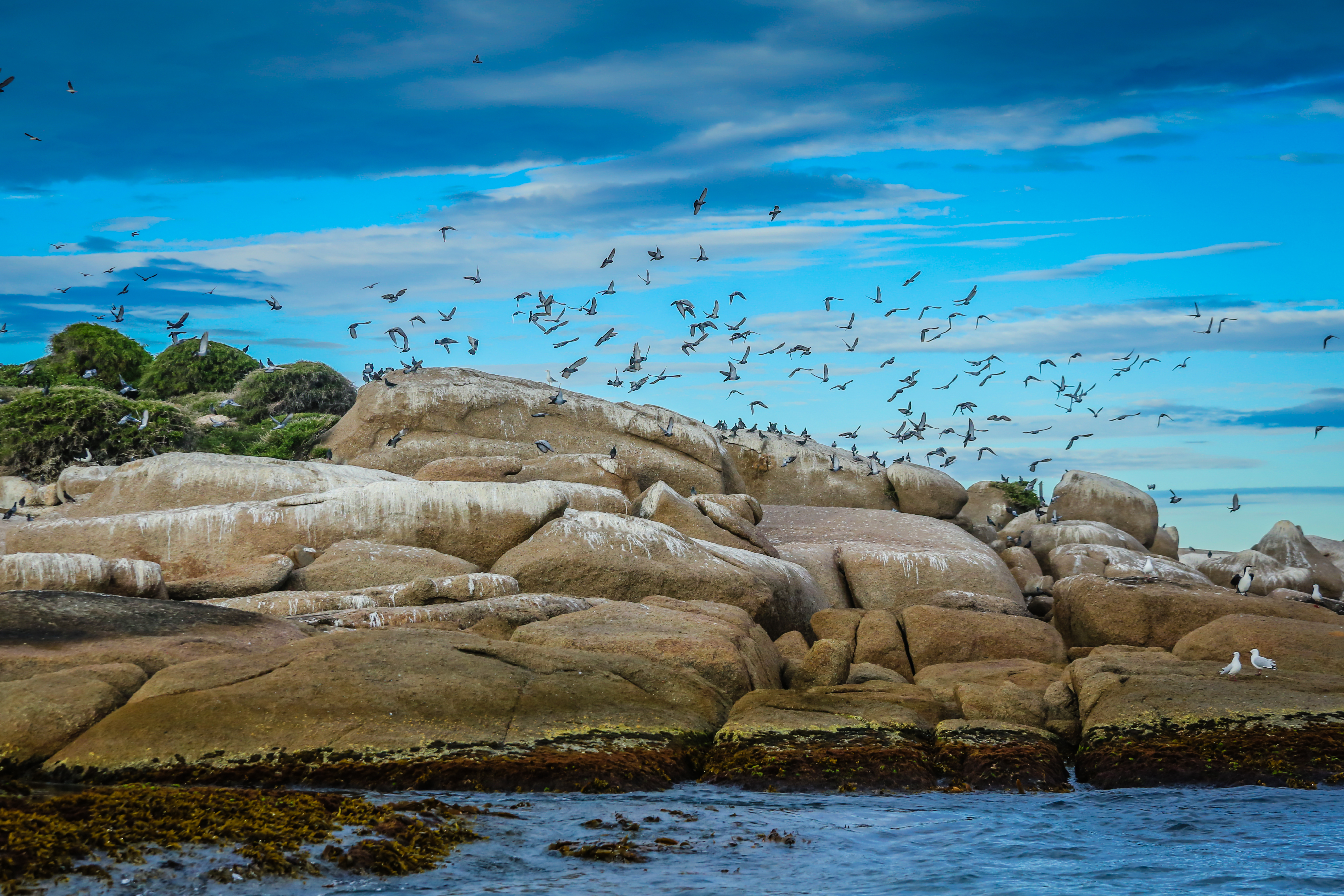
Our coast is a special place, with uniquely biodiverse and remarkable ecosystems, and is home to numerous species found nowhere else on Earth. Together, as land managers caring for the coast and its nearshore environments, we recognise how valuable it is, and how vulnerable it can be to a range of threats.
Extending from Sellicks Cliffs to the Murray Mouth, the region includes the entire Fleurieu Peninsula and seven offshore islands, spanning more than 170 kilometres, around five percent of South Australia’s coastline. It is rich in ecological, social, and cultural diversity. It has been a special place for Ngarrindjeri/Ramindjeri and Kaurna First Nations for over 65,000 years, with their dreaming and cultural identity deeply connected to the coastal features and seascapes we see today.
Building on the original Southern Fleurieu Coastal Action Plan and Conservation Priority Study (2007), this updated plan provides a framework to guide the conservation and management of the Southern Fleurieu coast’s natural resources, as well as the preservation and acknowledgement of cultural values. It identifies priority conservation areas for protection and recommends practical, on-ground actions to address key threats. Designed for government agencies, councils, First Nations organisations, community groups, and other coastal land managers, it supports a collaborative and consistent approach to management.
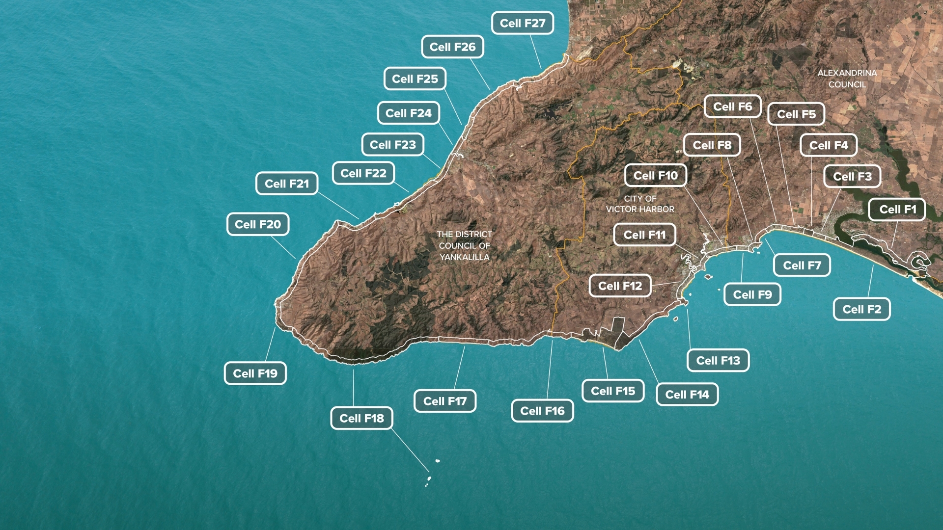
The plan divides the coastline into 27 sections, or ‘cells’, each presenting site-specific information, roles and responsibilities, and recommended management actions. This structure helps land managers focus on the most important actions for each area while keeping the broader coastline in view.
The plan is provided in three parts:
Part 1. Overview and regional priorities
Part 2. Cell descriptions (F1 – F27)
Part 3. Appendices - Maps, species lists and technical documents

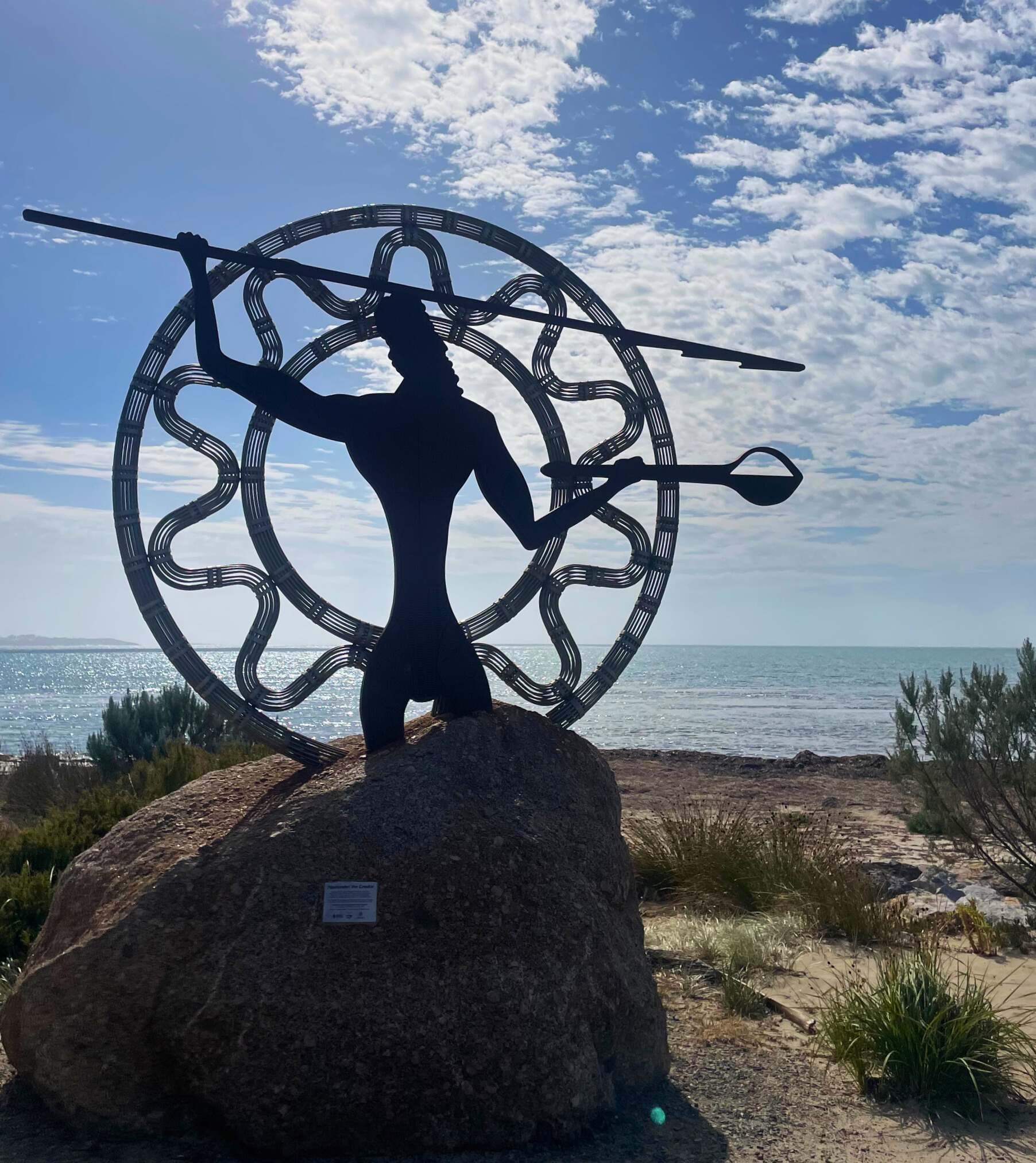
Traditional Owner and First Nations cultural statement
Every beach, reef, dune, cliff and estuary are part of a landscape that holds story of Country and its people.
Part 1 - Overview and regional priorities
The Southern Fleurieu Coastal Action Plan sets out the regional approach to managing the Fleurieu coast, including key priorities and recommended actions to guide coordinated, long-term care.
Part 1 provides the full strategic framework and foundations of the plan, outlining how it was developed, who it involves, and how it will be delivered in partnership with land managers, stakeholders and community. It sets clear regional priorities to strengthen ecosystems, support Traditional Owners, guide sustainable growth, build community stewardship, and respond to climate change, while also establishing how progress will be measured, reported and adapted over time.
The following regional priorities highlight key focus areas for improving the health and resilience of the Southern Fleurieu coast over the next decade. Each priority outlines clear outcomes and practical actions to guide land managers, support collaboration, and inform investment.
Together, these priority actions will restore habitats, reduce threats, protect biodiversity and assist climate adaptation, while also helping communities understand and contribute to the long-term care of our coastal, estuarine and marine environments.
Improving connectivity between coastal habitats supports species movement, enhances ecological processes, and strengthens resilience to environmental stress. By linking key areas such as islands, dunes, clifftops, saltmarshes, and estuaries, connected landscapes enable biodiversity to thrive and adapt more effectively to change. Strategic restoration and investment play a critical role in establishing these ecological linkages.
Improving condition of coastal ecosystems focuses on reducing direct pressures such as invasive species, erosion, pollution, and recreational impacts. Healthier habitats are better able to support native species, deliver ecosystem services, and recover from disturbances. Targeted management actions, including habitat restoration and threat mitigation will improve the overall quality and function of these environments.
Together, improved connectivity and improved condition create more resilient coastal ecosystems. Enhanced monitoring and data collection, especially for under-represented species, is needed to inform adaptive management and ensure long-term effectiveness. These efforts also expand opportunities for blue and teal carbon restoration, contributing to climate mitigation and nature-based solutions.
Priority actions
- Targeted threat reduction programs to manage pest plant and animal populations, recreational activities and implement erosion control and disturbance mitigation strategies in priority habitats.
- Implement ecological restoration across islands, dunes, clifftops, saltmarshes and estuaries to improve habitat condition and support increased species diversity.
- Allocate funding and resources to expand existing conservation areas and enhance the resilience of coastal ecosystems through strategic restoration and management.
- Introduce land-based impact mitigation measures such as improved stormwater management, vegetation buffers and pollution controls to protect coastal, estuarine and nearshore.
- Scale up large-scale habitat restoration initiatives across the coastline, including coastal heath restoration along the Fleurieu cliff lines and offshore islands, with sustained investment and cross-sector collaboration.
- Establish and maintain robust biodiversity assessments and monitoring systems to track ecosystem condition and change, including data collection for underrepresented species groups such as reptiles and invertebrates.
- Identify and restore blue and teal carbon habitats, leveraging opportunities to expand their coverage and enhance protection through blue carbon restoration programs.
Outcomes
- Medium (5 year) - Threats to priority coastal habitats are actively reduced, ecological condition and species diversity are measurably improved, and restoration efforts are scaled to strengthen habitat connectivity and resilience.
- Long term (10+ year) - Enhanced connectivity, ecological function, and long term protection of biodiversity across coastal habitats and ecosystems.
For full details on this priority - download the Part 1 of the plan.
Coastal and marine ecosystems are closely linked to the surrounding landscapes and catchments that flow into them. Strengthening ecological connectivity between land and sea is vital for maintaining the health of water-dependent ecosystems, especially as pressures from land use, climate change, and water quality increase.
Estuaries and nearshore zones act as key transition areas, supporting biodiversity, nutrient cycling, and habitat function. Marine ecosystems also rely on the integrity of upstream processes such as the flow of clean water, sediments, and nutrients from rivers and catchments to maintain ecological balance. Restoring these connections through improved catchment management, better water quality, and sustainable flow regimes builds resilience across both terrestrial and marine environments.
Priority actions
- Increase understanding of estuarine function and ecological requirements for long-term health and resilience.
- Conduct ecological assessments to improve understanding of species diversity and community distribution within coastal and nearshore environments.
- Improve and enhance monitoring programs to guide adaptive management of estuaries as vital connectors between terrestrial and marine systems.
- Clarify governance roles and responsibilities for estuary management to support coordinated and effective decision-making.
- Assesss and address land-based impacts such as stormwater runoff, pollution and sedimentation on nearshore marine environments.
- Strengthen coordination across land and sea management frameworks promoting integrated planning and conservation of interconnected ecosystems.
- Identify and implement habitat restoration opportunities across terrestrial, estuarine, coastal and marine ecosystems including seagrass rehabilitation, shellfish reef development, saltmarsh restoration, riparian corridor repair and artificial reef installation to enhance biodiversity, ecosystem services and climate adaptation.
Outcomes
- Medium (5 year) - Improved understanding, coordination, and management of terrestrial, estuarine, coastal, and nearshore environments as interconnected systems, supported by biodiversity assessments and enhanced monitoring, clarified responsibilities, and targeted restoration activities that strengthen biodiversity, habitat values, and ecological connectivity.
- Long term (10+ year) - Improved connectivity between land and sea systems to support water-dependent ecosystems, achieved through improved catchment management, enhanced water quality, and sustainable flow regimes.
For full details on this priority - download the Part 1 of the plan.
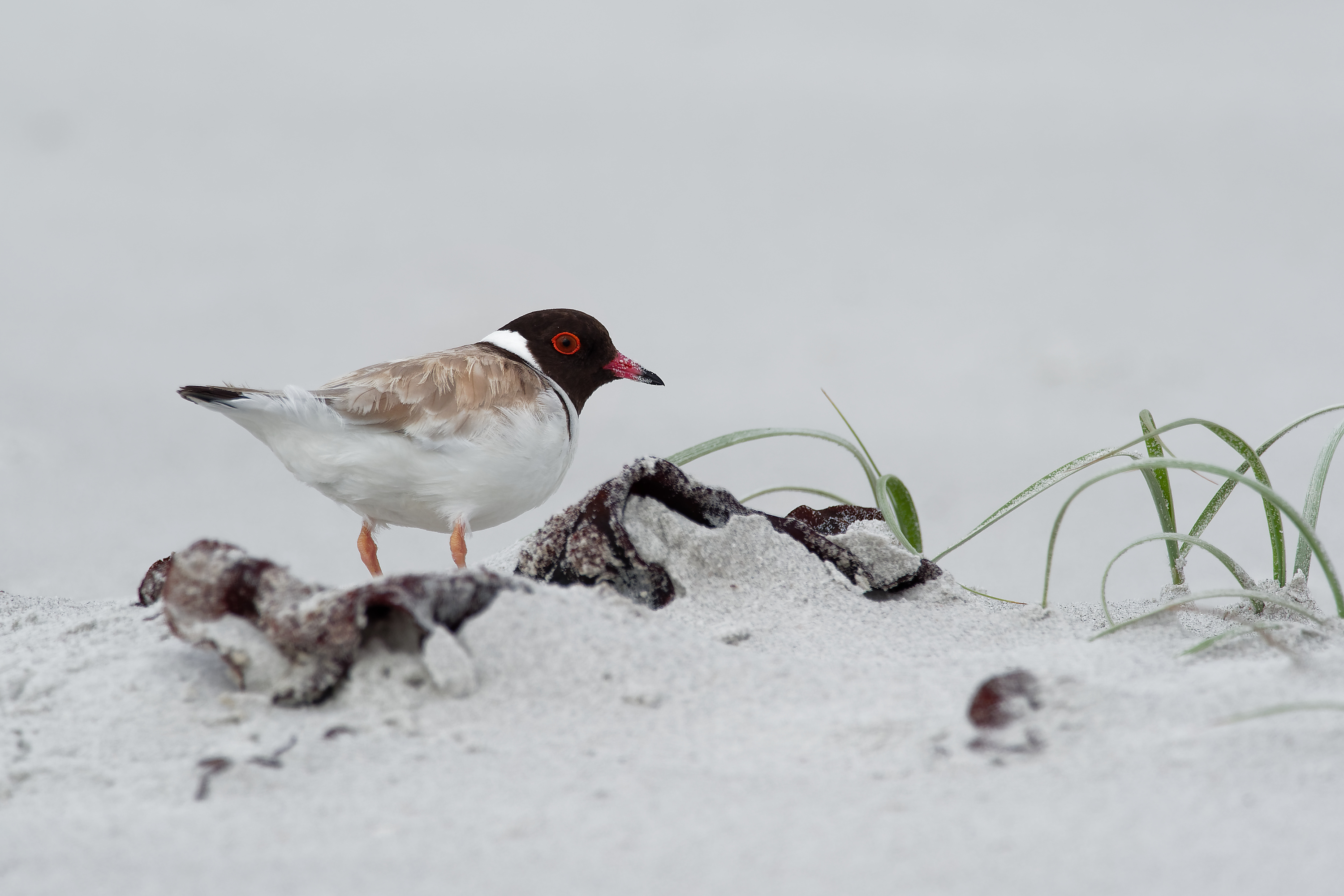
Protecting and conserving threatened species and ecological communities is critical to reversing decline and supporting long-term recovery. Many species and habitats of ecological significance are under increasing pressure from habitat loss, invasive species, climate change, and human disturbance.
Without targeted action, these values continue to face further degradation or risk extinction. Strategic efforts such as habitat restoration, threat reduction, and improved monitoring, are essential to stabilise populations, build ecological resilience, and guide adaptive management. By focusing on priority species and communities, conservation efforts will ensure that resources are directed where they are most needed to achieve meaningful outcomes.
The Hills and Fleurieu Landscape Board’s Action Plan for Threatened Species and Ecological Communities 2026-2040 sets out a coordinated, long‑term roadmap to halt and reverse biodiversity loss through targeted investment, on‑ground action, research, and partnerships.
Priority actions
- Strengthen protection of high-value reserves and threatened ecological communities across coastal, estuarine and marine environments through targeted management and policy measures, including improved statutory protections, enhanced water-quality and land-use controls, climate-resilient planning and active ecological management to safeguard biodiversity and ecosystem function.
- Expand the distribution of conservation-significant species and suitable habitats via habitat restoration, connectivity enhancement, rewilding initiatives and reduction of threats.
- Improve ecological knowledge by conducting biodiversity assessments, research and mapping of species and habitat distribution to better understand species requirements and community distributions.
- Elevate and formalise long-term protection of key conservation areas such as Tokuremoar Reserve, Morgans to Fishery Beach, Wright Island and the Normanville Dunes through strengthened planning and management mechanisms that recognise and secure their high ecological value.
- Support and resource volunteers and community nurseries to enhance and support conservation efforts, to propagate native coastal species (including species of conservation value) for habitat restoration and species recovery programs.
Outcomes
- Medium (5 year) - High-value coastal habitats receive increased protection and restoration to expand species distribution, improve ecological understanding, and increase active community involvement in conservation and rewilding actions.
- Long term (10+ year) - Improved trajectory of conservation rated species and communities of ecological significance.
For full details on this priority - download the Part 1 of the plan.
Traditional Owners hold deep cultural, spiritual, and ecological connections to land, sea and sky Country, with knowledge systems that support coastal environments over thousands of generations.
Strengthening respectful partnerships between indigenous and non- indigenous people and supporting integrated planning across land and sea Country ensures that coastal management reflects both cultural values and ecological priorities.
Building awareness of cultural heritage, traditional practices, and collaborative approaches enables communities and land managers work together more effectively. Increasing the capacity of Traditional Owners and First Nations groups to lead and participate in caring for coastal Country fosters more holistic, inclusive, and enduring conservation outcomes.
Priority actions
- Support Traditional Owners and First Nations communities to lead Country management by recognising their cultural authority, interests and deep connection to place.
- Traditional Owners and First Nations people actively caring for Country through cultural teaching and practices that support the renewal of cultural and ecological systems.
- Collaborate with Traditional Owners and First Nations groups to enhance conservation of coastal ecosystems and protect heritage values
- Establish and maintain partnerships that align cultural responsibilities with conservation goals, ensuring recognition and protection of cultural heritage.
- Integrate Sea Country planning and actively collaborate with Traditional Owners and First Nations People in coastal management and decision-making.
- Support Traditional Owners' cultural knowledge and aspirations to develop collaborative modern techniques for effective land and sea management practices.
- Facilitate connection and cultural education between Traditional Owners, coastal communities and land managers to strengthen collaborative stewardship.
- Deliver Traditional Owner-led training and resources to land managers and community members to improve understanding of cultural heritage processes, including site and artefact identification and reporting.
Outcomes
- Medium (5 year) - Stronger partnerships with Traditional Owners and First Nations groups lead to shared knowledge, improved recognition of cultural heritage, and more effective, collaborative management of land and sea Country.
- Long term (10+ year) - Traditional Owners and First Nations groups are supported and resourced to lead the care, management, and protection of land and sea Country through strong partnerships and integrated planning.
For full details on this priority - download the Part 1 of the plan.
Coastal regions face growing pressure from population growth, urban expansion, and climate-related impacts. Strategic planning is essential to ensure Ecologically Sustainable Development (ESD) that balances environmental integrity with social and economic needs. Stronger, integrated planning frameworks are needed to protect sensitive ecological habitats, manage risks to the natural and built environments and to people, and to build long-term resilience.
Strengthening coastal protection relies on collaboration across all levels of government, stakeholders, developers, and communities to deliver consistent, informed, sustainable, and adaptive development outcomes.
Priority actions
- Influence regional planning to ensure new developments areas are climate resilient and avoid high-risk coastal zones.
- Strengthen strategic planning processes by incorporating updated coastal hazard mapping, contemporary climate-change projections, nature-based adaptations priorities and alignment with Coastal Hazard Adaptation Plans ensuring consistent and long-term resilience across coastal communities.
- Review and update zoning classifications of coastal interface areas currently zoned as Primary Production or Rural, establishing conservation-appropriate buffer zones along the shoreline to strengthen protection of vulnerable natural coastal assets.
- Strengthen planning controls to prevent development in high-risk zones and safeguard areas identified for retreat or conservation of threatened ecological communities and species.
Outcomes
- Medium (5 year) - Coast and nearshore protection and climate adaptation measures are integrated into planning processes through collaboration across all levels of government, stakeholders, developers, and communities.
- Long term (10+ year) - Coastal development is ecologically sustainable and supports climate resilient communities.
For full details on this priority - download the Part 1 of the plan.
Coastal ecosystems are diverse, rich in biodiversity, and provide vital protection for shorelines. They support terrestrial, estuarine, and marine life; and offer cultural as well as recreational value to communities. These areas face growing threats from climate change, development and increased population, and pollution.
Strengthening public understanding and care for coastal environments is essential to their long-term protection. Promoting education, engagement, and local stewardship empowers communities to take part in conservation efforts, encouraging informed action and shared responsibility for safeguarding coastal ecosystems into the future.
Priority actions
- Promote responsible behaviours that support the protection of coastal species and habitats through targeted education and outreach.
- Engage and collaborate with land managers to reduce the impact of invasive and overabundant species on areas of conservation value.
- Raise awareness of recreational impacts on coastal ecosystems and encourage low-impact practices among visitors and local users.
- Support and expand citizen science programs to build community knowledge, improve data collection, and inform coastal management.
- Implement local initiatives to reduce threatening processes and activities affecting coastal habitats.
- Encourage best-practice land management to minimise stormwater runoff, pollution and other land-based impacts on coastal and nearshore environments.
- Facilitate networking and collaboration among coastal community groups and land mangers to strengthen collective stewardship and conservation efforts.
Outcomes
- Medium (5 year) - Communities have increased knowledge of, and engage in, coastal conservation through education programs, local initiatives, and participation in local conservation activities.
- Long term (10+ year) - Empowered land managers and communities actively protect coastal ecosystems through increased awareness, stewardship, and participation in conservation efforts.
For full details on this priority - download the Part 1 of the plan.
Climate change is placing increasing pressure on coastal, estuarine and marine environments. Rising sea levels, increased storm intensities, ocean warming, acidification, and shifting species distributions are already altering habitats and biodiversity. Algal blooms are likely to become more frequent, degrading water quality and disrupting marine food webs. Risks to coastal communities, settlements and natural ecosystems are recognised as two of the eleven priority climate risks identified in the Australian Government’s National Adaptation Plan.
Proactive, adaptive management is essential to address the growing impacts of climate change on coastal systems. Ecosystems such as seagrass meadows, reef systems, coastal dunes, cliff lines and estuaries provide critical biodiversity refuges, carbon storage and buffer shorelines from erosion and inundation. Many of these natural assets are already vulnerable and under significant pressure. Effective climate adaptation must therefore prioritise resilience-building measures, including targeted conservation and nature‑based solutions that harness the protective functions of healthy ecosystems.
For example, coastal dunes play a vital role in absorbing storm surges, reducing flooding and limiting erosion. Protecting, conserving and restoring coastal, estuarine and marine ecosystems delivers direct benefits for both natural and built environments.
Priority actions
- Strengthen understanding of climate hazards and their impacts on natural coastal, estuarine and marine land / seascapes and biodiversity.
- Assess and prioritise climate adaptation strategies, including nature-based solutions, for areas of high coastal, estuarine, and marine conservation value.
- Protect and restore natural environments to enhance the resilience of coastal, estuarine and marine ecosystems to climate hazards.
- Investigate and prioritise options that enable the landward retreat and migration of coastal, estuarine and marine habitats, supporting long-term biodiversity and ecosystem function.
- Establish or expand biodiversity assessment and monitoring programs to track environmental change, identify emerging risks and inform adaptive conservation management.
Outcomes
- Medium (5 year) - Climate adaptation planning, strategies and management for coastal, estuarine and marine environments embed nature connectivity and ecosystem health, reducing climate impacts and improving the condition of habitats.
- Long term (10+ year) - Coastal, estuarine and marine ecosystems have improved resilience and capacity to adapt to climate change, sustaining biodiversity and maintaining healthy, functioning natural systems.
For full details on this priority - download the Part 1 of the plan.
Part 2 - Cell descriptions
Each of the 27 cells provide location specific information to help land managers make informed decisions about the conservation and management of natural coastal assets. While each cell can be considered individually, they can also be viewed collectively, recognising the interconnected nature of the coast.
Click on the map to see all cell names and locations.
Download cell descriptions below
The cell descriptions are ordered by council districts below. You can click on the map above to see the full cell names if you are not sure which council district your cell is in.
-
 F1 Murray Mouth (Kandukang (west) and Tapalwora (east)), and southern shore of Hindmarsh Island (Kumarangk)
-
F2 Goolwa (Beach Road) (Kuitangk) to the Murray Mouth (Kandukang (west) and Tapalwora (east)): the Sir Richard Peninsula
-
F3 Goolwa (Kutiangk): Beach Road to Treleaven Place
-
F4 Tokuremoar (Tokuremoar) Reserve
-
F5 Surfers Beach, Middleton (Tokuremoar to Ratalang)
-
F6 Middleton (Ratalang) including Middleton Creek estuary (Ratalwar)
-
F7 Ratalang Bashams Beach (Ratalang) Conservation Reserve
-
F8 Fisherman Bay Headland (Camp Kondili) to Knights Beach (Port Elliot)(Kaindjeinuwald) including Pullen Island (Witung)
-
F9 Knights Beach and Boomer Beach (Kandjeinuwald)
-
F10 Watson’s Gap to the Hindmarsh River (Kaindjeini)
-
F10 Watson’s Gap to the Hindmarsh River (Kaindjeini)
-
F11 Victor Harbor (Pultang) (Hindmarsh River (Latung) to Inman River (Muwerang) including Granite (Kaiki) and Seal (Yandi) Islands)
-
F12 Inman River (Muwerang), Encounter Bay (Rosetta Harbour) (Ramong) and Wright Island (Ikirriwar)
-
F13 The Bluff (Longkewar)
-
F14 Petrel Cove (Longkewar) to Newland Head (Ngarakerung)
-
F15 Newland Head (Ngarakerung) to Parsons Beach (Waipingga)
-
F16 Parsons Beach (Waipingga) to Tunk Head (Tangkalang)
-
F16 Parsons Beach (Waipingga) to Tunk Head (Tangkalang)
-
F17 Tunk Head to Tunkalilla Beach (west) (Tangkalang)
-
F18 Deep Creek National Park (Konggaratingga) to Fishery Beach (including the Pages Islands (Maralangk and Meruwi)
-
F19 Fishery Beach (Parrewar-angk) to Cape Jervis (Pariwa)
-
F20 Cape Jervis (Pariwa)(Patpangga) to Rapid Head (Witawateng) (Yerta Kulangga)
-
F21 Rapid Bay- Rapid Head (Yerta Kulangga) to Boat Harbor, Second Valley (Kauweyerlongga)
-
F22 Second Valley (Kauweyerlongga) to Lady Bay (Yangkalyilla)
-
F23 Lady Bay (Yangkalyilla) to Bungala River (Pangkarla)
-
F24 Bungala River (Pangkarla) to SW bank of Carrickalinga Creek (Karrapootungga)
-
F25 Carrickalinga Creek (Karrapootungga) to Carrickalinga (Karrakalingga) Head
-
F26 Carrickalinga (Karrakalingga) Head to Myponga (Maitpangga) Head
-
F27 Myponga (Maitpangga) to Sellicks Cliffs (Witawali)
Part 3 - Appendices - Maps, species lists and technical documents
-
Cell 1 Base map
-
Cell 2 Base map
-
Cell 3 Base map
-
Cell 4 Base map
-
Cell 5 Base map
-
Cell 6 Base map
-
Cell 7 Base map
-
Cell 8 Base map
-
Cell 9 Base map
-
Cell 10 Base map
-
Cell 11 Base map
-
Cell 12 Base map
-
Cell 13 Base map
-
Cell 14 Base map
-
Cell 15 Base map
-
Cell 16 Base map
-
Cell 17 Base map
-
Cell 18 Base map
-
Cell 19 Base map
-
Cell 20 Base map
-
Cell 21 Base map
-
Cell 22 Base map
-
Cell 23 Base map
-
Cell 24 Base map
-
Cell 25 Base map
-
Cell 26 Base map
-
Cell 27 Base map
Note: there is no nearshore habitat map for Cell 1
-
Cell 2 Nearshore habitat map
-
Cell 3 Nearshore habitat map
-
Cell 4 Nearshore habitat map
-
Cell 5 Nearshore habitat map
-
Cell 6 Nearshore habitat map
-
Cell 7 Nearshore habitat map
-
Cell 8 Nearshore habitat map
-
Cell 9 Nearshore habitat map
-
Cell 10 Nearshore habitat map
-
Cell 11 Nearshore habitat map
-
Cell 12 Nearshore habitat map
-
Cell 13 Nearshore habitat map
-
Cell 14 Nearshore habitat map
-
Cell 15 Nearshore habitat map
-
Cell 16 Nearshore habitat map
-
Cell 17 Nearshore habitat map
-
Cell 18 Nearshore habitat map
-
Cell 19 Nearshore habitat map
-
Cell 20 Nearshore habitat map
-
Cell 21 Nearshore habitat map
-
Cell 22 Nearshore habitat map
-
Cell 23 Nearshore habitat map
-
Cell 24 Nearshore habitat map
-
Cell 25 Nearshore habitat map
-
Cell 26 Nearshore habitat map
-
Cell 27 Nearshore habitat map
You might also like:
Southern Fleurieu Coastal Action Plan Acknowledgements
The Southern Fleurieu Coastal Action Plan acknowledges that all lands and waters of the region are Aboriginal lands and waters. It recognises and respects the continuing relationship of Traditional Owners and First Nations peoples with Country, and their knowledge, authority and custodianship that guide cultural and environmental care. The plan seeks to uphold these relationships through ongoing collaboration, respect and recognition of Aboriginal peoples as the first and continuing custodians of the Fleurieu coast.
The preparation of this plan has been informed by engagement with Aboriginal organisations, cultural advisors and community representatives. The Hills and Fleurieu Landscape Board acknowledges and thanks the Ngarrindjeri Aboriginal Corporation, local Ramindjeri and Kaurna Meyunna Elders for their guidance, cultural knowledge and continuing commitment to caring for Country. Their perspectives have shaped the understanding of place, values and priorities reflected throughout this plan.
Please respect that cultural concepts and content included in this plan are the Aboriginal Cultural and Intellectual property (ACIP) of the Ramindjeri people of the Ngarrindjeri Nation (provided by Cedric Varcoe, Ramindjeri Cultural Leader living on Country) (cells 1-20) and Karl Winda Telfer of the Mullawirra Meyunna (Kaurna Meyunna) (cells 20-27). They may not be used or adapted by any other parties without consent.
The update of this plan would not have been possible without the contributions and support of many organisations and individuals. We thank everyone who provided input and acknowledge the shared responsibility we all have in caring for the Southern Fleurieu coast. Special thanks to:
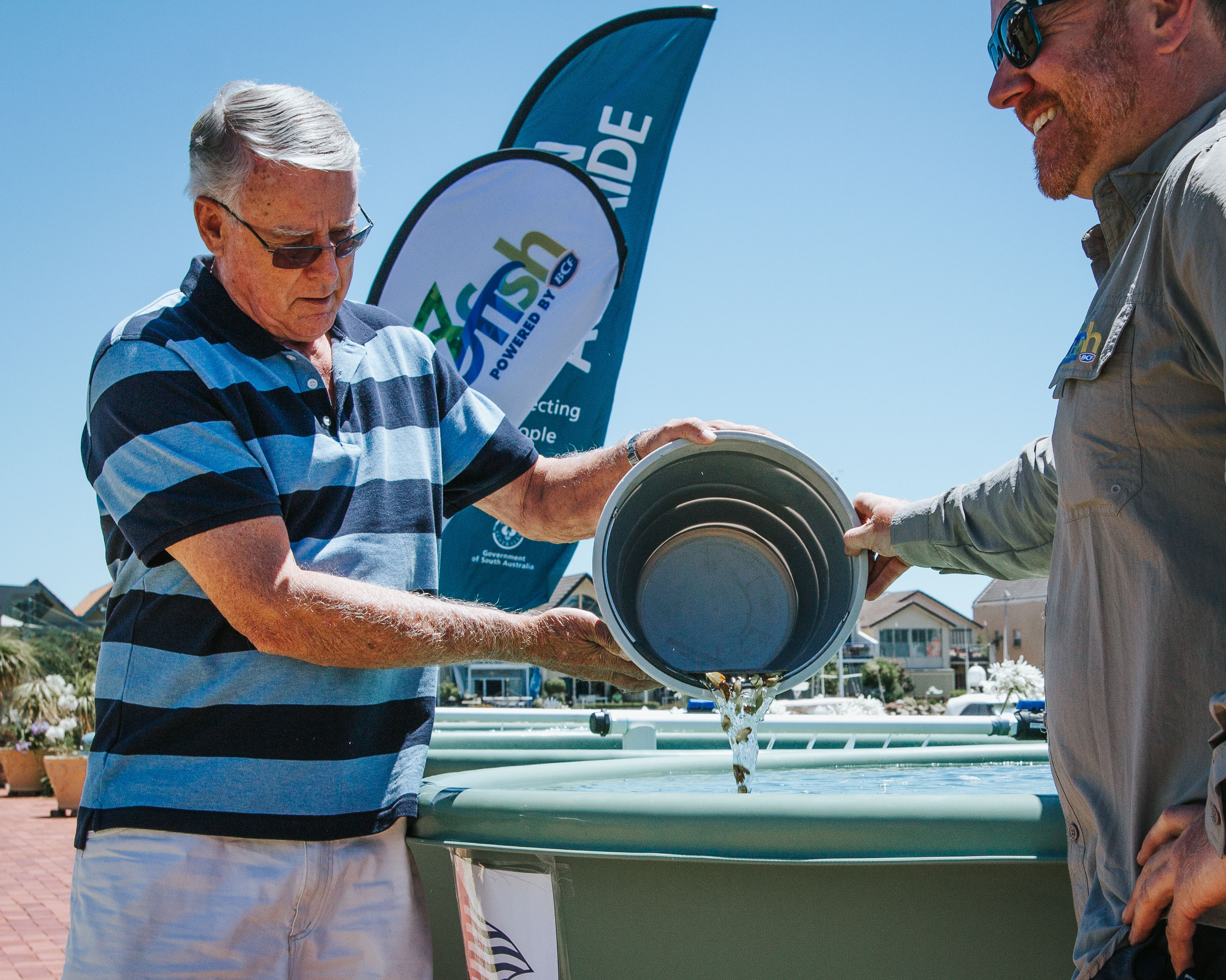
Alexandrina Council , City of Victor Harbor, District Council of Yankalilla, SA Water, Department for Environment and Water, National Parks and Wildlife Service, Kanyanyapilla, Ngarrindjeri Aboriginal Corporation, Landscapes Hills and Fleurieu, Green Adelaide, BirdLife Australia, Second Nature Conservancy, SA Shorebirds Foundation, SteamRanger Heritage Railway, Coastal community groups and 'Friends Of' groups.
Authors and citation
This publication may be cited as: Taylor, C., Bryars, S., Turner, A., Peters, K. (2026) Southern Fleurieu Coastal Action Plan 2026. Prepared by Hills and Fleurieu Landscape Board.
Authors
- Caroline Taylor - Coast & Marine Project Officer, Landscapes Hills and Fleurieu
- Simon Bryars - Principal Marine Scientist, Science and Information Unit, Department for Environment and Water
- Alison Turner - Coastal Scientific Officer, Coast Unit, Biodiversity Science, Coasts and Information Branch, Department for Environment and Water
- Kristian Peters - Senior Scientific Officer, Green Adelaide
Thank you to the many staff, community members, technical experts, and individuals who generously shared their knowledge and experience to help shape this plan. In particular, we acknowledge Alex Stolarski, Andrew Burnell, Ben Greeneklee, Ben Simon, Ben Westmoreland, Bronson Symmonds, Caroline Dorr, Carolyn Schultz, Cedric Varcoe, Claire Lock, Corey Jackson, Daniel Ball, Darryl Cowan, Jeremy Freeman, Julia Roetman, Karl Winda Telfer, Keith Jones, Kerri Bartley, Luke Price, Martin Stokes, Matthew Endacott, Matthew Turner, Megan Harper, Monika Rhodes, Raechel Lewis, Sam Sutherland, Seiji Iwao, Sophie McKay, Tony Flaherty and Warrick Barnes.